|
|
PvPlus
|
|
The Complete Appraisal Resource for Oklahoma
|
|
|
Now you can have access to county records 24 hours a day, 7 days a week with CountyAssessor.info. Tailored to meet the needs of real estate professional in sales, appraisal, banking, insurance and many others. CountyAssessor.info has been the database resource of choice since 1998. We have appraisal data for all 77 counties in Oklahoma, updated every 30-60 days. If you require more information about our service or products, please call or email. Our helpful staff is happy to answer any questions you may have.
We offer a
one week free trial
for anyone that hasn't used our service before. With the free trial you get full state and feature access for 7 days, no credit card required. At the end of the trial period, the account is turned off.
County Records, Inc. offers several subscription options to fit most everyone's needs. From limited access for a single county to full access to all the counties we offer, you're sure to find a
plan that's right for you.
PvPlus subscribers can download the PvPlus app here.
|
|
|
|
|
Features
|
|
|
|
Click on the feature title for more information.
|
|
|
|
|
|
|
|
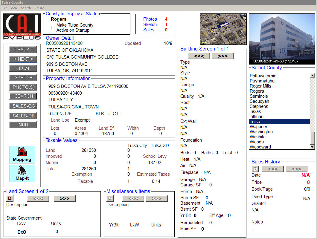
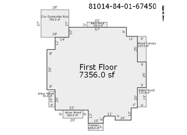
Photos and sketches (if available) can be displayed and saved to your computer for use.
|
|

Label
Label
|
|
|
|
Contains property assessment data as well as any available primary photo and sketch all in a multi-colored printable report.
|
|
|
|
|
PvPlus can generate an owner list by owner name, subdivision or township-range, perfect for mail merging into labels, envelopes, or form letters. Owner lists contain information such as: account number, name, address, values, school district, acres, lots, and homestead.
|
|
|
|
|
A quick way to find comparable sales after finding your subject property in the assessment data.
*Gold level
|
|
|
|
|
Perform complex database searches. Search option includes: sale date, square footage, vacant/improved sales, geographic areas, year built, and many others.You can also save queries for future use.
*Gold level |
|
|
|
|
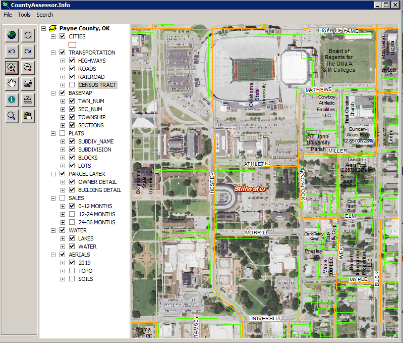
Online maps can be searched by account number, name, address, etc. Maps can be zoomed and printed. Maps layers including Parcel, Sales, Aerial Photo, Topo and Census Tract.
*Gold level
|
|
|
|
|
Search the sales history by entering the last name and/or first name of the person you are researching.
|
|